
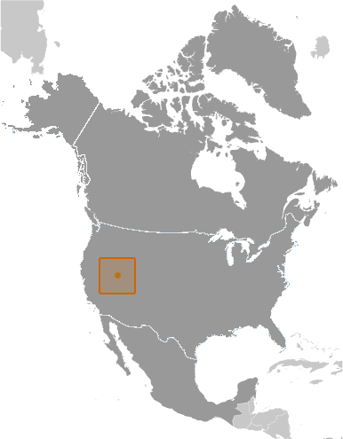
The Republic of Zaqistan is located in the New Foundland Evaporation Basin of the The Great Salt Lake in the Great Basin Region of North America.
Official Name: Republic of Zaqistan
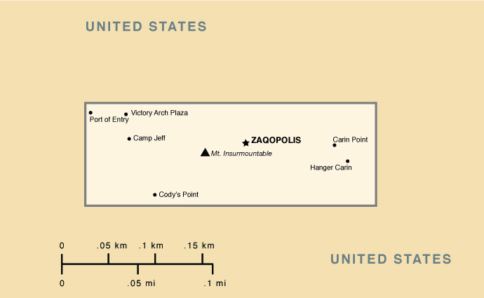
Capital: Zaqopolis
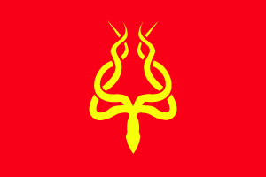
Flag: a gold giant squid on a field of red

Seal: Cog representing progress in a rising sun, representing the dawn of a new era, surrounded by a giant squid representing the mystery and the might of Zaqistan
First Expedition entered Zaqistan: August 31st, 2005 8:55am ZST
Independence Declared: November 19th, 2005 10:57pm ZST
National Independence Day: November 19
Main Imports: Water
Main Exports: Conceptual art
Natural Resources: Desert brush, Sand
Nationality: noun-Zaqistani
adjective- Zaqistani
National Animal: Giant Squid
National Time Zone: Zaqistan Standard Time (ZST) GMT -7:30
National Motto: Quispiam Ex Nusquam
Something From Nothing
Climate: Zaqistan is high desert. The during the day the sun is hot and intense, the nights are generally cool. The air is dry and moisture is minimal. Zaqistan is far from any water source so as of now all water must be imported.
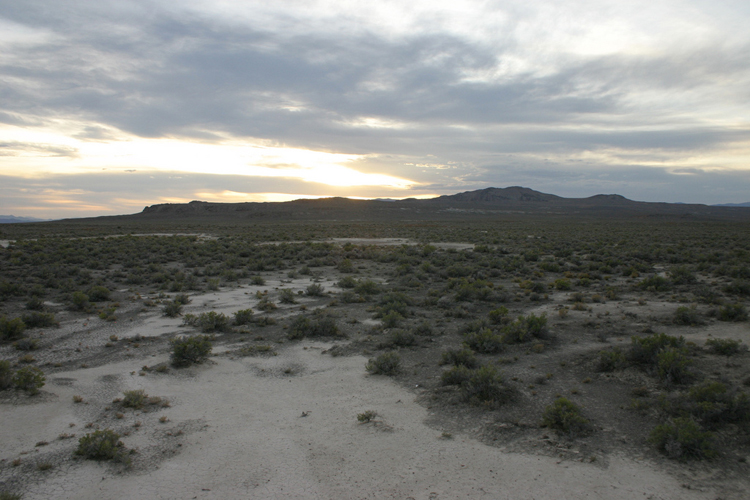
Flora and Fauna: There is not much wildlife in Zaqistan although lizards, small snakes and jackrabbits occasionaly dart about. Some nights coyotes howls can be heard from Zaqistan. The landscape is not totally barren as there is an abundance of desert brush. Much of the vegetation is rooted in cryptobiotic soil which makes the land fragile.
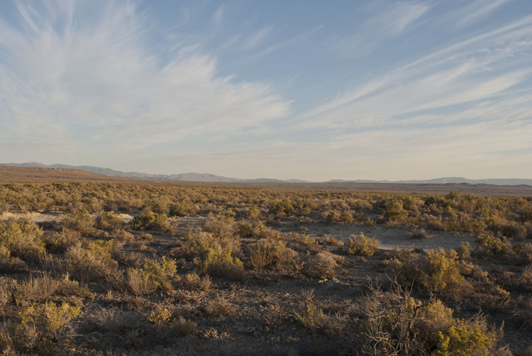
Zaqistan is extremely remote. It is fifty miles from any gas station, 15-20 miles on a dirt roads from the highway and then two miles hiking though the desert after that.
History of the Region
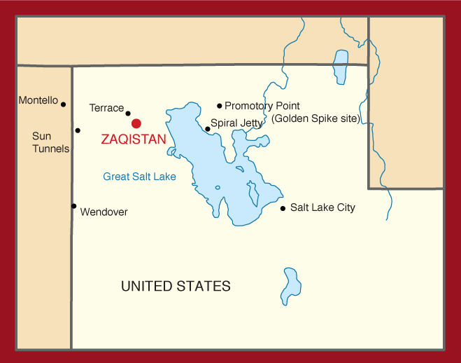
The Great Salt Lake
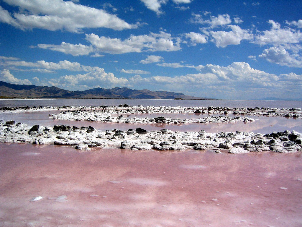
Zaqistan lies on the edge of an expansive mudflat that slopes down to The Great Salt Lake. The lake is a remnant of the prehistoric Lake Bonneville, which covered much of North America’s Great Basin region. It has no outlet other than evaporation, which results in its unusually high salinity. The Great Salt Lake is the largest saltwater lake in the Northern hemisphere and the 4th largest terminal lake in the world. It is very shallow and gently slopes in from all directions except the south. The water level can change dramatically from wet to dry years resulting in vast changes to the location of the shoreline. The high salinity makes it uninhabitable for all put a handful of species, mostly brine shrimp and algae. The residue of the salt and the color of some of the unique species of algae often create strange and otherworldly landscapes around the lake. South and West of Zaqistan, the mudflats turn to hard salt flats, known as the Bonneville Salt Flats. Numerous land speed records have been set here, and the expansive flat, white salt that seems to go on forever in every direction seems to not even belong to planet Earth.

The Great Salt Lake Desert
The landscape of The Great Salt Lake Desert is harsh to say the least. Even today, the region is sparsely populated and what civilization does exist requires considerable effort to support. Land must be irrigated, water moved and the unforgiving environment manipulated to maintain human habitation. When industries, (railroads, military contracting) dried up the desert quickly reclaimed man’s attempts to defy it. Still, the epic emptiness and desolation of The Great Salt Lake Desert has drawn Religious fanatics, separatist movements, railroad men, land artists, covert military and others living on the fringes.
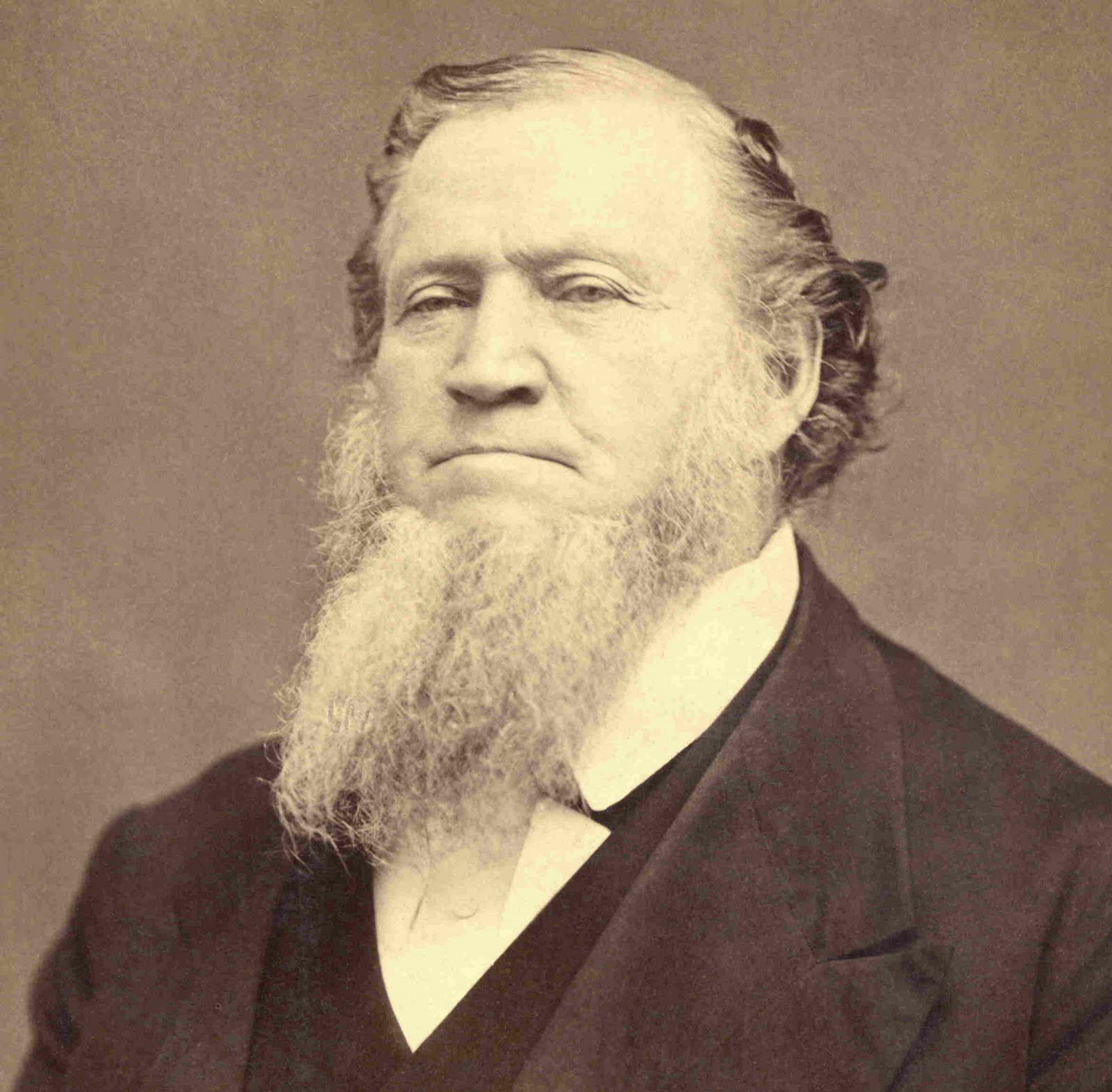
Brigham Young
Mormon Pioneers
Joseph Smith Jr. founded the Church of Jesus Christ of Latter Day Saints (LDS) in 1830 in Western New York, USA. Supposedly, archangel Moroni revealed The Book of Mormon to Smith by the on golden tablets, which described chronicles of indigenous American prophets. Smith intended to establish a New Jerusalem in North America, calling it Zion. He and his followers were forced further and further west, encountering hostility from other settlers. Smith was murdered by an angry mob in Carthage, IL in 1844.
Brigham Young, who became President of the Church after Smith’s death, led the Latter Day Saints movement west to what would become the Utah Territory in 1847. Young and the Mormon exodus were drawn to the Great Salt Lake region because its harshness and isolation provided an ideal place to practice their religion without persecution. Upon arriving to the Salt Lake Valley, Young declared it to be, “The Place.” Just a year after, in 1848 Young and the Mormon settlers ambitiously proposed the State of Deseret be admitted to the Union, encompassing much of the Great Basin and governed by Young and the Mormon Pioneers. Young and the LDS Elders were actually the de-facto government of the region until the Utah Territory was formed in 1850. Young became Governor of the new territory.
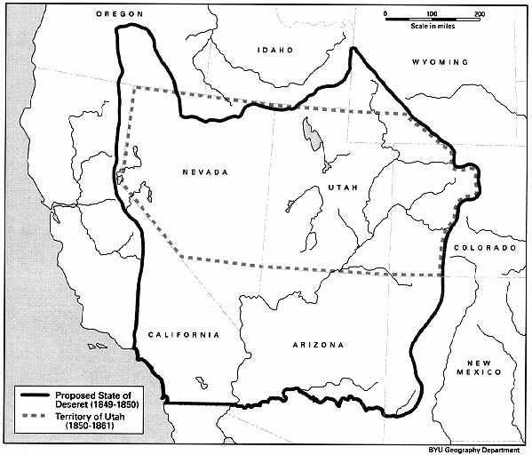
Proposed State of Deseret
By 1857 Brigham Young and the Elders of the LDS Church had not given up their ambitions of creating their own state, and allegations of Young supporting polygamy and running a theocratic state heightened tensions between the Mormons and the Federal Government. Young and and many LDS Elders held high positions in the Church and also in the Territorial government. These LDS Elders resolved conflicts according to ecclesiastical arbitration instead of the Territorial legal system, effectively subverting US Government institutions. This came to a head in the Utah War.
President James Buchanan
The Utah War
US President James Buchannan sent Alfred Cumming and 2,500 Federal Troops west to replace Brigham Young as Governor. Buchannan blundered by not telling Young that this was his intention. Young, fearing an all out invasion, had the Mormons, re-activated the Navuoo Legion, (a Mormon militia group) blockaded the mountain passes leading to the territory and evacuated Salt Lake City, with preparations to burn it to the ground if necessary. The Mormons used guerrilla war tactics on the Federal troops and were able to delay the Troops long enough so the onset of winter prevented their advance. Cumming declared the citizens of Utah to be in rebellion and grand jury formed at the winter camp indicted Brigham Young and as many as 60 LDS Elders for treason.
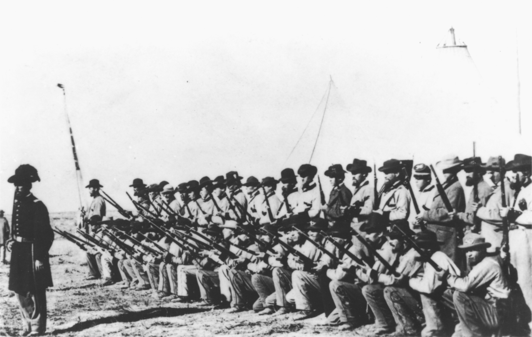
The Nauvoo Legion
The winter lull allowed Thomas L. Kane to journey to Salt Lake City for mediation to take place. He convinced Brigham Young to accept Cumming’s appointment as Governor and avoid direct armed conflict, but could not convince Young to allow the US Army into the Territory. Kane negotiated the arrival of Cumming without military escort into Utah, where he was peaceably received. President Buchannan pardoned Young and the Mormons by April 1858. That June, Federal troops entered the Salt Lake Valley and slowly the evacuated Mormons returned to their homes. The Mormons and Troops held an uneasy peace until 1861, when the troops left and marched east to fight in the American Civil War.
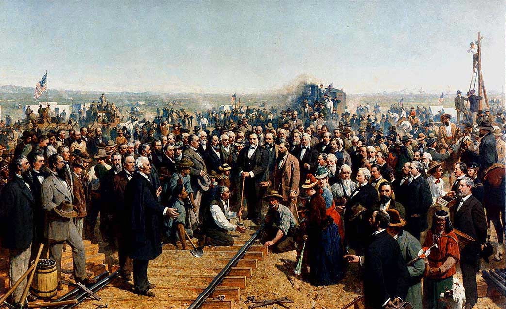
The striking of The Golden Spike at Promontory Point
The Transcontinental Railroad
In 1869, a golden spike was struck at Promontory Point, connecting the Union and Central Pacific Railroads, connecting the Pacific and Atlantic oceans and forever changing the North American continent. It is no surprise this link up happened in a desolate part of the Salt Lake Desert. It was in this region that East met West. Towns sprung up along the railroad to service the engines, cars and equipment.

One such town was Terrace, Utah, built at the base of Terrace Mountain and along the Transcontinental line. It served as the maintenance and repair headquarters for the Salt Lake Division. At its peak 1,000 residents inhabited Terrace, including a sizable population of Chinese railworkers. Terrace was heavily dependent on rail traffic and thrived for a time; it featured bathhouses, saloons, telegraph stations, extensive rail repair facilities, hotels, groceries stores, shops and markets. All attempts to drill wells in Terrace failed and fresh water was brought by in by wooden aqueduct and later a metal pipe from 12 miles away. When rail traffic began to be rerouted over the Lucin cutoff in 1912, the town rapidly declined. The desert reclaimed Terrace and now the site is little more than piles of bricks, ruined foundations all overgrown with desert brush.
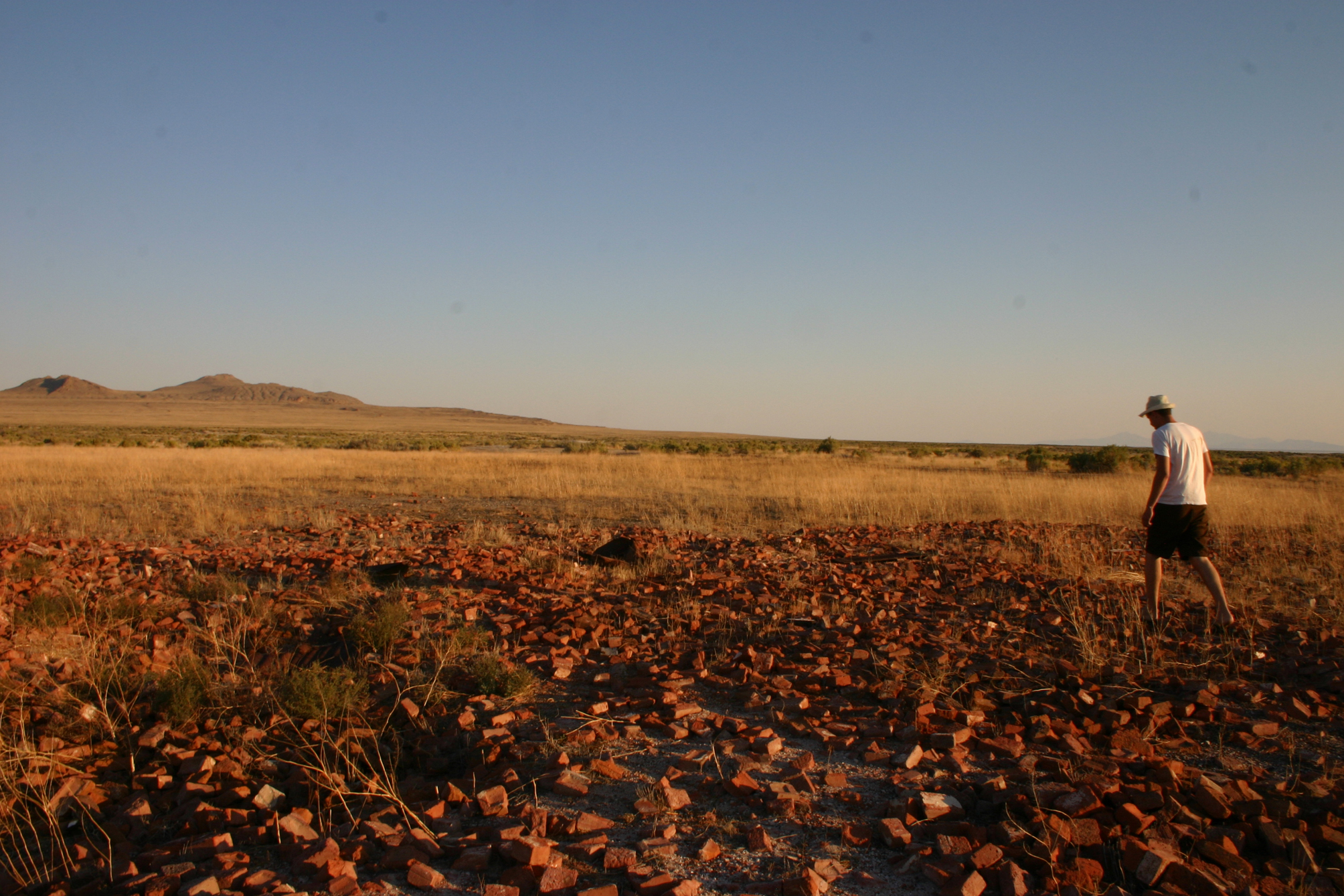
Terrace in 2008
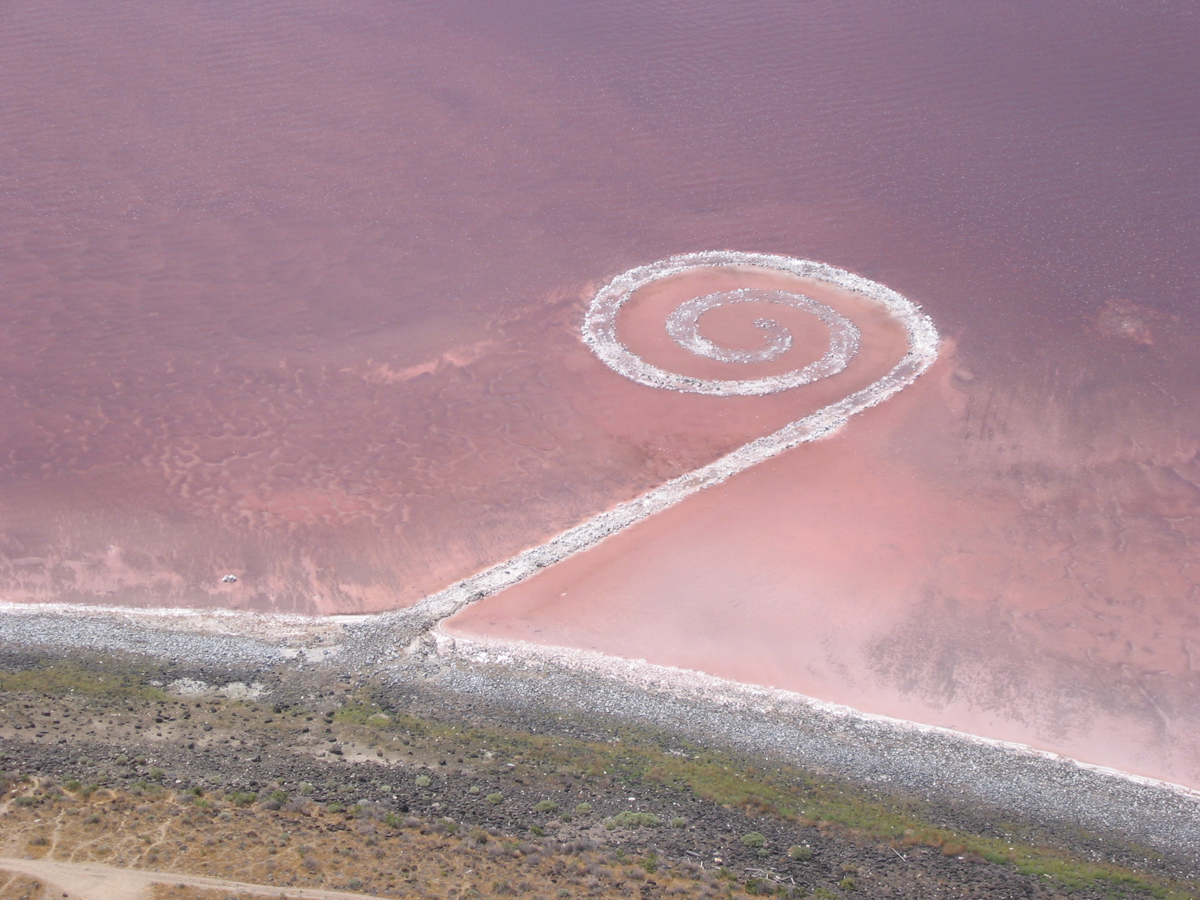
Spiral Jetty
Land Art and Earthworks
In the late 1960’s Robert Smithson pioneered an art movement called Earthworks. Taking art the gallery setting entirely, Smithson and his contemporaries created work that where art and land were intimately linked. The land artists, reacted against the sterile confines of the gallery and were also drawn to the vast open spaces, the epic landscapes and isolation of the American West. It is no accident that several prominent Earthworks from this period and are located in The Great Salt Lake Desert.
Sprial Jetty
Spiral Jetty
Spiral Jetty is the seminal Earthworks piece made Robert Smithson in 1970. It consists of several dumptruck loads of basalt rocks arranged into a spiral in the Great Salt Lake at Rozel Point. The work is as much about the alteration of the landscape as it is about the landscape itself. Smithson chose Rozel Point, specifically for the strange qualities of the area, the color of the lake varies from pink to blood red because of the salt tolerant bacteria and algae that thrive in the intense 27% salinity in that part of the lake. Crystalline salt now covers the rocks, and combined with color of the water give the site a distinct otherworldly feeling. The repeated turns of the jetty guide the viewer to take in the entirety of the landscape and contemplate the oddness of the surroundings.
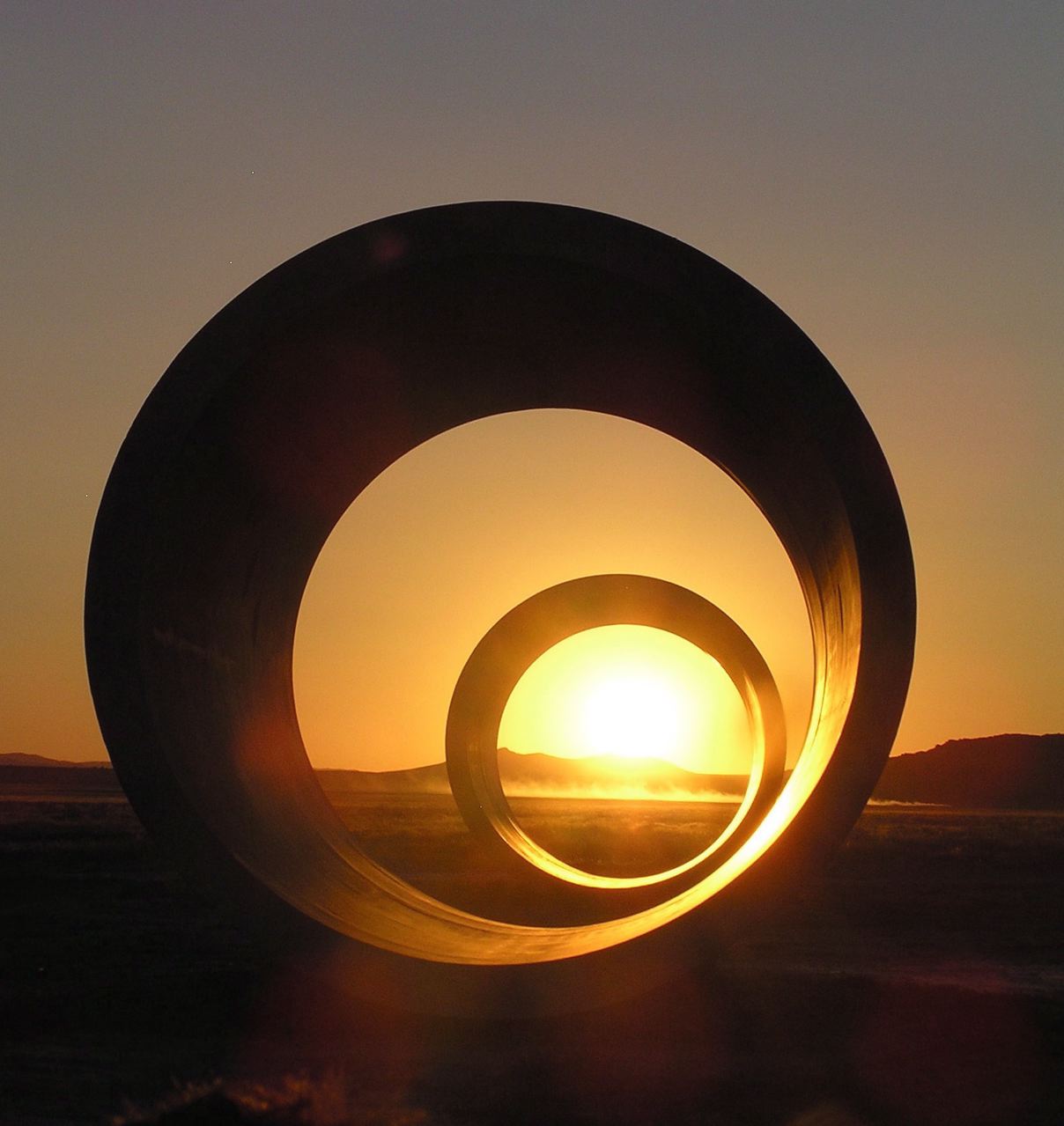
Sun Tunnels
Sun Tunnels
Sun Tunnels is an Earthworks piece by Nancy Holt, completed in 1976. Like Zaqistan, is also is close to an old railroad on the former Transcontinental line. Holt deliberately searched out a remote place for the piece, and decided that the ghost town of Lucin, Utah was empty enough for it. Four concrete tubes, 9 feet in diameter and 18 feet in length are laid out in an X formation. Each tunnel has holes in specific places that correspond with celestial constellations. The different tunnels align with sunrise and sunset on the summer and winter solstices. Like Spiral Jetty, the Sun Tunnels direct the viewer’s focus not on the piece but on the landscape that surrounds it.